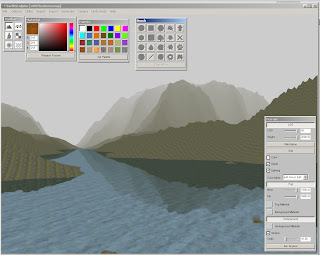
I had some problems before I figured out how to make the imported map to get the correct size. The solution was really easy. When opening the program the first time it will open a default map of the size 257x257, and any height map I imported, regardless of size would be resized to 257x257. What I needed to do was to make a new map (File->New, chose 4097x4097). Now when I import an image of 4096x4096, it will be the size I wanted.
To be able to see the height properly in ES one can change the height. This will not change anything when the image is exported, only how the landscape is drawn. In the Terrain window there is a slider called Height. This goes from 0-300 as a default. This slider can be changed as 300 is a bit too small to see all the details. In the EarthSculptor folder there is a file called EarthSculptor.ini, it can be opened in a text editor. I change the “maxTerrainHeight” from 300.000000 to 2000.000000.
At the max height of 2000, I set the Water level to 51,58, this corresponds more or less with the water level in game (that is when I lower the land with -h -2048 in TESAnnwyn when I make the esp).
 EarthSculptor is really easy to use, and has all the features that I need. With the help of brushes I can lower, raise the land, smooth and so on.
 Now I will play around some more and see what I can make :)

No comments:
Post a Comment