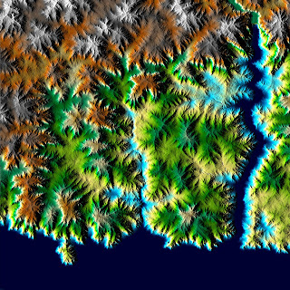
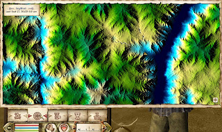
When I tested my 16 x 16 quad world I felt there were some problem areas: The world felt too small for what I had in mind and the terrain was flattened out to much. I have now decided to divide the world into 5 pieces trying to use rivers and mountains as natural barriers between each section. The idée is that each section should be up to 16 x 16 quads. The mod will primarily be in section 1 and 2, but I worked a bit on 3, 4 and 5 as well to have the height map ready if I ever want to expand the mod more. The idée is that the player can’t cross the mountains except for specific mountain passes, and that the two large rivers are too big to swim, so they can only be crossed by boat or bridge. I have to figure out how to make connections between the separate sections, but that will have to be a later problem.

The next issue was the flattened feeling of the world. I fixed with a lot of work in GeoControl2 and PS.
First, GeoControl works best if the height range of the image is between 100-0%, not 100-76% gray that is what Oblivion can handle (see previous posts). I had my map in 100-76%, so I fixed it with the brightness function in PS. Image -> Adjustment -> Brightness/Contrast. I changed the brightness to +150 two times to get the height range I needed.
I divided the height map image in to sections of 4096x4096 pix + an overlap with the next section, so the final size of each section was 4608x4608. I used the guide tool in PS to make sure that everything was strait (View->New Guide-> vertical and horizontal lines in pix on image). I then had to resize each section to 4096 to be able to run them in GeoControl.
First I used High sedimentation-invers and High fluvial terraces-invers to get sharp edged mountains. Then I run Thin flows deep-invers, Thin flows sediment, Thin flows deep and Mountains ridged to get the nice eroded effects I wanted.
I have put a zip file here with the settings files if anyone is interested.

Next problem was to glue everything back together again. The exported files from GeoControl were first resized again to 4608pix so they could overlap, and then with the help of the guide lines I could put them back in the original image where they belonged.
 Now there wasn’t a perfect match between sections, as you can see, so before I merged the layer together I had to even things out. I erased some of the overlapp from one section and it worked, I could not see the division anymore.

One new problem was that much of the big rivers had disappeared when GeoControl did its thing. I solved the problem by making a separation in the height map in PS, painting in a “lower” color in the gap. The borders between land and river didn’t look so good, the edges were to sharp. I divided it into sections with overlap, run it in GeoControl, and glued it back together again. The result was a big nice looking river!

Last thing to do before I turned the height map into an .esp file with TESAnnwyn was to lower the colors back so the range was in between 100 and 76% gray again, by the use of Brightness -150 two times in PS. There was a high mountain that needed fixing with more lowering, but it was only a small area.
 The darker height map doesn’t look much in GeoControl, but in game those mountains are huge! And they have lots of details too :)

/E


