There are two guides that I have read for making an in-game map, Silgrad Towers guide for an in-game map and Nexus Wiki, Oblivion custom in-game map.
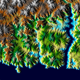
First I needed an image for my in-game map, as a start thought I use a 2D representation from GeoControl. I took the 16384 x 16384 pix height map image and resized it to a resolution Geocontrol can handle 2048 x 2048, and saved it as a tif, 16 bit grayscale. In Geocontrol I exported a image of the landscape. Generation -> Image Export / Colour -> jpg

The max size that Oblivion can handle for an in-game map is 2048 x 2048, and it also has to be in an image format the game recognizes, a dds file. I used a plug-in for GIMP to convert my jpg to a dds.
One of the guides said to put the image file in Data\Textures\map\”your_mod_name”, the other in Data\Textures\Menus\map\world\, I used the later and it have worked fine.
In the CS, I loaded my esm, World -> World spaces. Under Map Data, Add Image File, brows to where the file is located.
Usable Dimensions X: 2048 Y: 2048 (this is the size of the map).
Cell Coordinates NW Cell X: -256, NW Cell Y: 255, SE Cell X: 256, SE Cell Y: -255 (the cells the map should cover).
Save as a new esp.
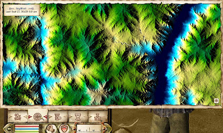
When I test it out in the game, I mark both my esm and the map esp.

Works really well :)
/E

No comments:
Post a Comment